Rural Japan & City Dreams
Japan’s Rice Terraces: The Work Behind the View
From Niigata to Mie and Nagano, three terrace landscapes reveal the water systems, shared work and everyday decisions behind a beautiful view.
7 MIN READ
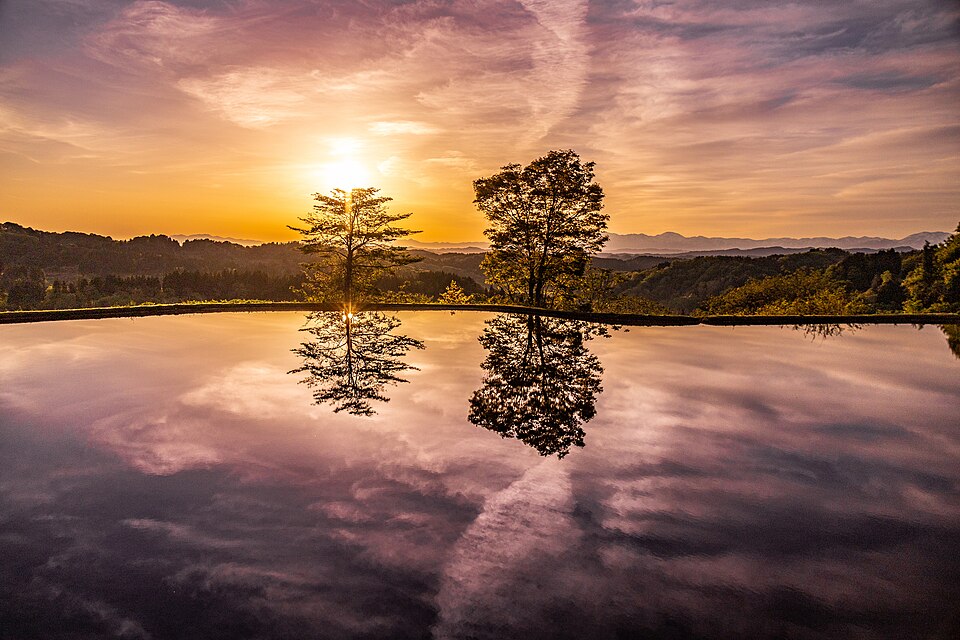
Photo: Koichi Hayakawa / Wikimedia Commons / CC BY-SA 2.0. Resized; original composition retained.
From a distance, Japan’s rice terraces look like a drawing made with water: curved lines across a hillside, each small field catching a different patch of sky.
Look a little longer and other details come into focus. A narrow bank holds the edge of a paddy. A channel brings water from somewhere beyond the photograph. A road has to reach fields that do not fit neatly into rectangles. The view begins to make more sense when you ask how someone works here.
What makes a hillside into a rice field?
Tanada are rice paddies arranged in steps on sloping ground. Each terrace creates a relatively level space where rice can be cultivated. Japan’s Ministry of Agriculture, Forestry and Fisheries describes them as agricultural landscapes sustained by both farming and shared work within local communities.1
Notice the relationship between the flat surface and its raised edge. Seen from above, that edge makes a pleasing line. At field level, it is part of the structure that allows the paddy to function. Earth banks, retaining walls and water channels deserve as much attention as the reflections.
That is a useful way to begin looking at a terrace landscape: choose one small field and follow its boundary. Then consider how it connects to the field above, the field below and the nearest access path.
The work continues between planting and harvest
A study of irrigation in Japanese terrace landscapes identifies work that a distant view can hide: maintaining long channels, distributing water among many small plots, cutting vegetation along banks and preventing leaks. Some systems pass water from one paddy to another, requiring careful operation as well as physical upkeep.2
The familiar photographs of planting and harvest show only parts of that work. A cultivated hillside also depends on people returning to check, adjust and repair it. An empty-looking field may still belong to an active seasonal routine.
Maintaining terraces is demanding. The agriculture ministry notes the cost of working difficult terrain and the shortage of people to continue as rural populations decline and age. A beautiful view alone does not tell you whether the work behind it is secure.1
Three places, three things to notice
Hoshitoge, Niigata: look beyond the reflection
At Hoshitoge in Tokamachi, around 200 paddies spread across the slopes. The Japan Tourism Agency describes the interconnected fields as a landscape shaped by generations of rice cultivation. It also explains how water-filled paddies and their surroundings support insects, frogs and other wildlife.3
The opening photograph brings you close to one reflective surface, with trees and morning sky mirrored in the water. The bank at its far edge is a reminder that even this apparently seamless view depends on a carefully contained field.
Maruyama Senmaida, Mie: a landscape people brought back
Kumano City records a decline in Maruyama’s terraces to 530 paddies, followed by restoration through cooperation between local residents and the municipality. The city now lists 1,340. Its English guide describes the small plots, stone walls and substantial hand work involved in keeping them cultivated.4
That history changes the way to read the photograph. The pattern is the result of decisions to keep working particular pieces of land. Look for the differences in size and shape: they help explain why maintaining so many separate plots takes care.
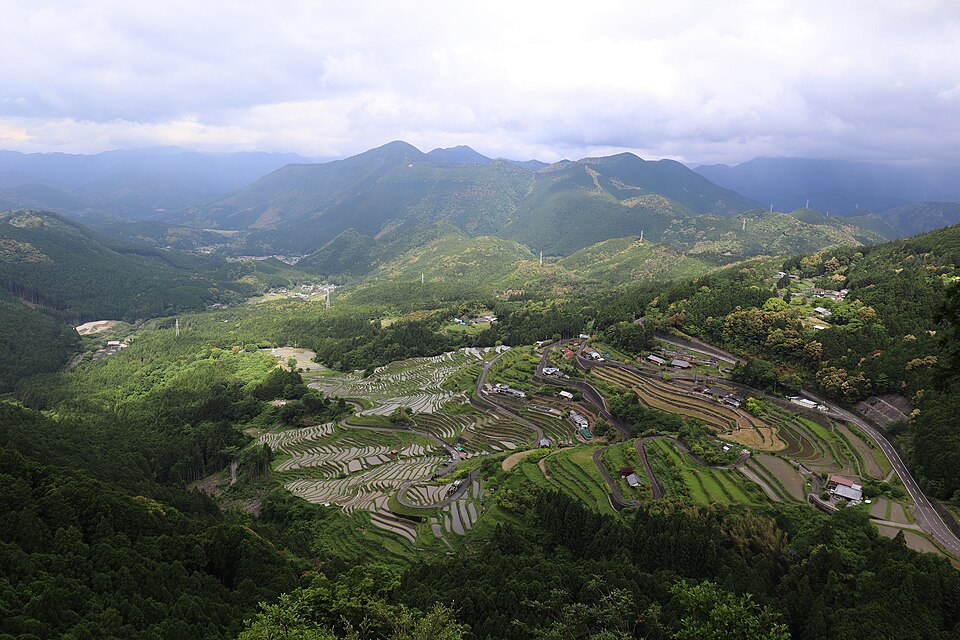
Photo: Nakai_Chan / Wikimedia Commons / CC BY 4.0. Resized; original composition retained.
Obasute, Nagano: follow the water beyond the field
Obasute’s terraces overlook the Chikuma River and the broad basin below. Chikuma City’s account of this Important Cultural Landscape connects the hillside fields to a larger water system: Oike pond, the Sarashina River, irrigation channels and methods for moving water between paddies.5
The city describes tagoshi, in which water passes over earth banks from one field to the next, alongside an underground drainage system called ganise. These details make the landscape easier to understand. The visible terraces are one part of an arrangement that reaches upstream and below ground.
From the viewpoint in the photograph, you can also see how close the fields are to homes and the wider valley. The setting helps place the terraces within an inhabited landscape, with connections extending beyond the edge of the frame.
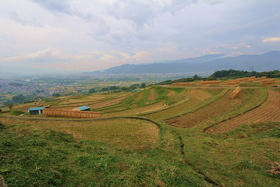
Photo: くろふね / Wikimedia Commons / CC BY 3.0. Resized; original composition retained.
Visit as a guest in someone’s working landscape
Tokamachi’s tourism association stresses that Hoshitoge’s fields are privately owned farmland. Its visitor guidance provides a useful starting point for thinking about a terrace visit; follow the specific signs and access rules wherever you go.6
- Keep to permitted viewing areas and routes. A narrow bank between paddies is not an invitation to step onto the field for a photograph.
- Leave space for farm work. Park only where permitted, keep access clear and let agricultural vehicles pass.
- Leave plants and crops where they grow. Take litter home, and ask before photographing people at work.
- Check conditions before travelling. Water levels and field colours change with cultivation and weather. At Hoshitoge, winter snow can make the viewing area inaccessible; consult the official visitor information.
A photograph can help you decide what interests you, but it cannot promise the same light, water or access on the day you arrive. The three places here are in different regions of Japan. Treat them as separate examples to explore, rather than a single day’s route.
A connection that can last longer than a photograph
The Japan Tourism Agency describes support programmes in Tokamachi through which members contribute to continued cultivation, receive rice and may take part in planting or harvesting. These arrangements connect people outside the community with the work of keeping fields in use.3
If that appeals to you, ask the local organiser about its current programme, language support and participation requirements before making plans. Buying locally produced rice or joining an organised activity can also give you a reason to learn the name of the place behind the view.
On your next look at a terrace photograph, start with the water. Follow it to an edge, then to another field. The lines become easier to read once you notice the practical decisions inside them—and the people whose work keeps those lines visible.
Sources & further reading
- Ministry of Agriculture, Forestry and Fisheries: rice-terrace communities and their conservation (Japanese).
- 棚田保全に必要な水利施設とその管理の実態 — research abstract on irrigation facilities and terrace management, published on J-STAGE (Japanese).
- Japan Tourism Agency: Hoshitoge Rice Terraces.
- Kumano City: Maruyama Senmaida and its restoration (Japanese), and English introduction.
- Chikuma City: Obasute’s terraces as an Important Cultural Landscape (Japanese).
- Tokamachi Tourist Association: Hoshitoge visitor information and etiquette. Check here for current access conditions.
The three photographs are archival images of the named locations. Each image credit links to its source and licence. Images are resized to 960 × 640 pixels with their original composition retained; the applicable licence continues to apply to each photograph.



Comments