Local Railways · Fukushima & Niigata
The Tadami Line: A Slower Journey Through Rural Japan
River views, village stations and a railway that found its way back.
RURAL JAPAN & CITY DREAMS · 7 MIN READ
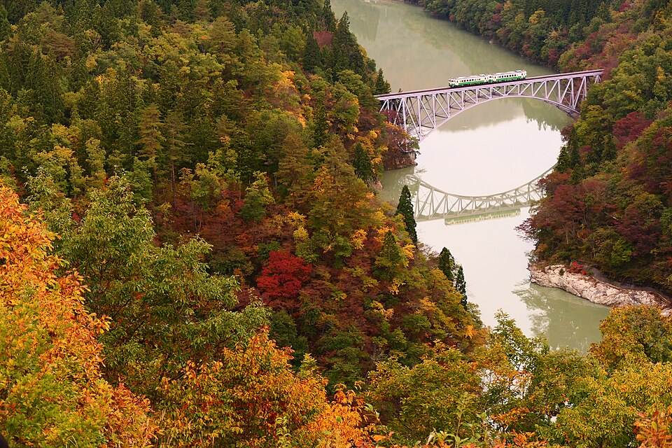
Photo: MaedaAkihiko, 30 October 2019, via Wikimedia Commons · CC BY-SA 4.0. Reduced-resolution version; no crop or retouching by LAYERS OF JAPAN.
A river below the window, a village beside the tracks, mountains beyond: the Tadami Line offers a reason to give a journey more time.
A photograph can make a railway look like a single perfect moment. A small train crosses a bridge, the water holds a reflection, and the hills fill the frame. Travelling the line asks for a different kind of attention: to the stations between the celebrated views, to the timetable, and to the people for whom this landscape is home.
For visitors looking beyond Japan’s major cities, the Tadami Line is an invitation to make a modest plan and leave space around it. You do not need to collect every viewpoint for the journey to feel worthwhile.
A railway through inhabited country
The Tadami Line runs 135.2 kilometres between Aizu-Wakamatsu in Fukushima Prefecture and Koide in Niigata Prefecture. Its route crosses a region where heavy snow shapes everyday movement. The parallel Route 252 closes at the prefectural border in winter, giving the railway particular importance as a connection between communities. [1]
Bridges, tunnels, wooded slopes and the Tadami River give the line much of its visual character. The official railway portal also introduces the food, crafts and settlements along the route—useful reminders that a railway journey can lead into a place, rather than simply past it. [2]
Try looking for smaller details between the famous views: the shape of a station entrance, a road running beside the tracks, the moment a hillside opens into a settlement. These observations do not require a perfect season or a clear sky. They only require looking up from the map.
The line that came back
Heavy rain in July 2011 caused severe damage, including washed-away bridges. The section between Aizu-Kawaguchi and Tadami remained closed for around eleven years, with replacement buses maintaining a connection. After restoration work, through service across the entire line resumed on 1 October 2022. [1]
Knowing that history changes the meaning of a bridge photograph. The train in the landscape is also part of a story about continuity: whether a small place can remain connected, and what it takes to restore a route after disaster. There is room for both responses—for enjoying the beauty and for recognising the work behind the journey.
Ride the view—or watch the train?
First decide which experience matters most. Riding across a bridge and photographing a train from a hillside require different plans. The viewpoint is a separate destination; a picture taken from it does not show the view from your seat.
For the First Tadami River Bridge, Mishima Town directs visitors to the viewing path beside Michi-no-Eki Oze-Kaido Mishima-juku. From Aizu-Miyashita Station, the roadside station is about 3.5 kilometres away—roughly a 45-minute walk—followed by the climb to a viewpoint. It is not a short stroll from the platform. [3]
The municipal bus provides another possibility, but it does not run on Sundays, public holidays or during the New Year closure. The return service from the roadside station requires an advance request under the town’s arrangements. Check the current instructions before relying on it; taxis also need to be arranged rather than assumed to be waiting. [3]
Plan the return connection first. Then decide how much time you have for the path, photographs and a break. A beautiful viewpoint is less enjoyable when the final train is already becoming a worry.
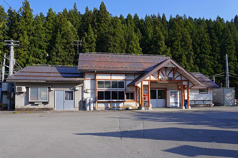
Photo: Mister0124, 23 April 2023, via Wikimedia Commons · CC BY-SA 4.0. Reduced-resolution version; no crop or retouching by LAYERS OF JAPAN.
Build a small journey around the timetable
You can approach the Fukushima end from Tokyo via the Tohoku Shinkansen to Koriyama, then the Ban-etsu West Line to Aizu-Wakamatsu. On the Niigata side, a route runs via the Joetsu Shinkansen to Urasa and the Joetsu Line to Koide. Check the connections for your actual travel date. [4]
Use JR East’s current Aizu-Wakamatsu timetable as a starting point when travelling from that end. It separates weekday and weekend or holiday schedules. Check your destination and onward journey too; one departure time is not a complete itinerary. [5]
For a first visit, a manageable outline might be:
- Choose one main aim. Make the day about a rail journey, one town, or the bridge viewpoint. Add another stop only when the connections leave comfortable time.
- Write down both directions. Include the journey back to your accommodation and any bus or taxi arrangement, not just the outward train.
- Leave a gap. A meal, a missed photograph or an unexpected shower should not require rebuilding the entire day.
An overnight stay can make room for a less hurried visit, but a shorter journey is also a valid choice. The full route is an option, not a test you need to complete.
Let the season change the plan
The official visitor guide presents distinct seasonal landscapes: fresh greenery, summer river mist, autumn colour and deep winter snow. Those are possibilities, not appointments. Mist, foliage and reflections depend on conditions; an image made on one morning cannot promise what you will find on another. [4]
The autumn and winter photographs in this article show the same bridge in different years. Looking at them together is more useful than choosing a single “best” version of the railway. Each season changes what you notice—and how you need to prepare.
Before a viewpoint visit, consult Mishima Town’s recent viewpoint updates. These dated observations help put a famous photograph back into current conditions. Recheck the forecast and railway information before setting out, especially for a winter journey. [6]
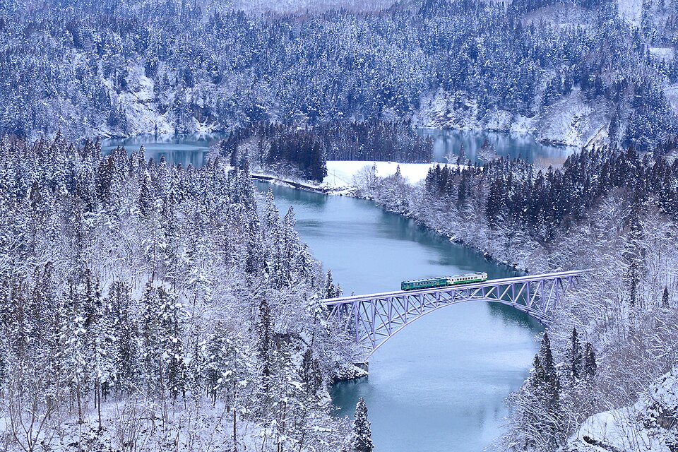
Photo: MaedaAkihiko, 7 February 2020, via Wikimedia Commons · CC BY-SA 4.0. Reduced-resolution version; no crop or retouching by LAYERS OF JAPAN.
Bring a little preparation, and some patience
Mobile reception can be unreliable along parts of the route, so save the maps, connections and accommodation details you need before travelling. For winter visits, the official guide recommends suitable warm clothing and footwear for snow. [4]
Confirm your ticket or pass arrangements in advance, keep some cash as a backup, and follow the instructions displayed at stations and on the train. Pack water and something to eat rather than building a tight connection around an unconfirmed shop opening.
At viewpoints, stay on designated paths and leave room for others. Around stations and villages, keep entrances clear, ask before photographing people closely, and remember that railway tracks are never a place to stand for a better picture.
Leave room for the place
A good rural journey does not have to produce a long list of things done. Time for a local meal, a walk that fits the timetable, or a quiet wait at a station can be enough. Check opening hours, make the arrangements you need, and allow the place to set part of the pace.
The Tadami Line can begin as a photograph you want to see for yourself. Let it become something slightly larger: a journey through a region that continues beyond the edge of the frame.
Sources & further reading
- Fukushima Prefecture: the Tadami Line and its restoration — route, winter connectivity, flood damage and full reopening.
- Official Tadami Line Portal: about the line. The portal also provides an English introduction.
- Mishima Town: access to the First Tadami River Bridge viewpoints — walking route, municipal bus and return arrangements.
- Official Tadami Line Portal: useful travel information — approach routes, seasonal preparation and mobile reception. For departures, use current JR East information rather than older timetable graphics.
- JR East: Aizu-Wakamatsu station timetables. See JR East for current travel information.
- Mishima Town: recent viewpoint conditions.
Photo credits, original file pages and licences appear beneath each image. These photographs were taken in 2019, 2023 and 2020; they illustrate particular places and seasons, not a guarantee of current train appearance, facilities or weather. Each photograph remains available under its stated CC BY-SA 4.0 licence.




Comments