Anime Pilgrimage · Seiseki-Sakuragaoka, Tokyo
Whisper of the Heart: A Walk Through Seiseki-Sakuragaoka
Follow a winding hillside through the Tokyo neighbourhood that helped shape a Ghibli favourite, from the station’s Youth Post to a small shrine and a familiar roundabout.
ANIME & FANDOM · 5 MIN READ
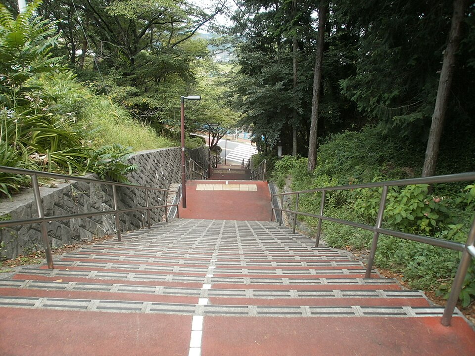
On Irohazaka, the distance between a film scene and an ordinary street is measured in steps.
Handrails descend through trees towards a bend in the road. Beyond them is a town where people catch trains, climb hills and return home. In Seiseki-Sakuragaoka, in Tokyo’s Tama City, those everyday journeys carry a special resonance for viewers of Whisper of the Heart.
Released in 1995, the Studio Ghibli film was directed by Yoshifumi Kondo, with a screenplay and storyboards by Hayao Miyazaki, from Aoi Hiiragi’s original work.1 Tama City identifies the area around Seiseki-Sakuragaoka Station as an important reference for its backgrounds.2 A walk here lets you explore the landscape that the filmmakers transformed into a story.
Begin at the station, with a small wish
Outside the station’s West Exit, look for the Youth Post, or Seishun no Post. The local tourism group, bringing together shopkeepers and fans, installed this monument to the film. Visitors can post a letter describing a dream or goal and wish for its fulfilment. A walking-map board stands beside it.2
It makes a thoughtful beginning: take a moment to consider what you would put in such a letter before setting off. If you hear a familiar tune at the station, there is a reason. Tama City confirms that its train-approach melody uses the film’s theme, “Country Roads,” with different versions for the two directions.2
Save the local tourism group’s walking map on your phone; an English version is available. It connects the station with Sakura-dori, Kasumigaseki Bridge, Irohazaka and the hillside stops.3
Irohazaka: let the climb set your pace
Follow Sakura-dori away from the station and cross the river towards Irohazaka. The road curls uphill, while stairways provide a more direct climb. Tama City’s account of its 2025 anniversary walking tour follows this same progression and highlights the staircase associated with the film.4
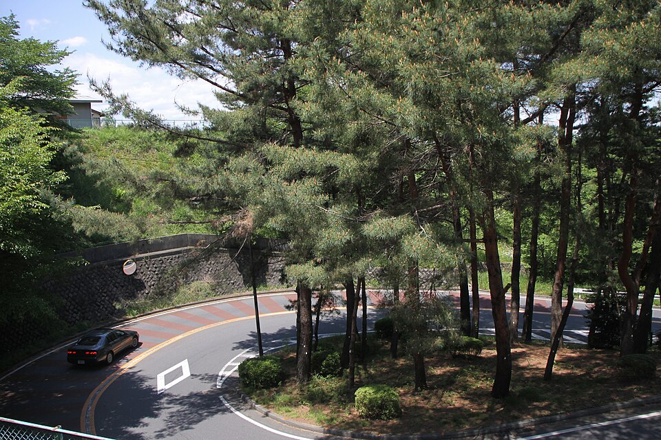
The first photograph captures the long descent between handrails. The next shows how a road bends around a wooded pocket of the hill. Together, they make the changing height easy to understand. Pause where there is room, look back and let the shape of the neighbourhood come into focus.
Irohazaka Sakura Park is a useful pause along the way. The walking map links the park to the location of the film’s library;3 treat it as a place to explore the setting rather than an address for that fictional building. Tama City lists the park and Irohazaka-dori among its cherry-blossom spots, usually at their best from late March into early April.5 Actual flowering varies by year.
Konpira Shrine: a quiet moment above the town
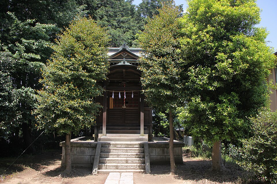
Continue uphill to Konpira Shrine, labelled “Kompira Shrine” on the English map. The map identifies it as the reference for the shrine where Sugimura tells Shizuku how he feels.3 Knowing the scene gives a small neighbourhood shrine an unexpectedly personal quality.
The place also has a history well beyond cinema. Tama City’s digital history names its deity as Omononushi-no-Mikoto and records the tradition that the shrine was established from Shikoku during the Bunsei era, in the early nineteenth century.6
In the photograph, a short flight of stone steps leads to a modest wooden building, framed closely by trees. Give the precinct a few quiet minutes. The local map specifically reminds visitors that this is a residential area.3 Keep the approach clear for worshippers and neighbours, and take photographs without turning the visit into a performance.
Finish at the roundabout
The Sakuragaoka roundabout is a natural destination for the uphill walk. Its connection with the film is also documented by Parthenon Tama Museum, whose collection includes an aerial photograph of the neighbourhood from December 1968.7 That older record is a reminder that the streets had their own story before audiences recognised them.
Take in the curve of the road from the pavement, then consider a break nearby. The tourism map marks Noix Confectionery and Dining Wazakura beside the roundabout.3 Check current opening information if either is part of your plan. Leave enough time to enjoy the neighbourhood without making every stop depend on finding an exact camera angle.
Plan an unhurried half-day
Use the Keio Line to Seiseki-Sakuragaoka Station, KO27; Keio’s station page provides current timetables and a station map.8 Tama City describes the rail journey from Shinjuku as roughly 30 minutes.4 Your actual journey depends on the service and waiting time.
- Start at the West Exit: find the Youth Post and check the walking map.
- Climb gradually: continue through Sakura-dori to Irohazaka, with a pause at the park.
- Visit the shrine and roundabout: allow room for photographs and a refreshment stop.
- Keep the return flexible: retrace a suitable public route, allowing extra time for the downhill sections.
As an editorial planning suggestion, reserve two to three hours locally, plus your train journeys. Wear shoes suited to slopes and steps. If stairs are difficult, review the route before committing to the climb: the winding road still gains height, and the map warns of narrow pavements and road crossings.3
You may arrive looking for a familiar scene and leave remembering something smaller: the light through a tree, the effort of a climb, or the wish you considered at the station. Those details can make this corner of Tokyo feel like part of your own story.
Sources & image notes
- Studio Ghibli — Whisper of the Heart (Japanese): production credits and release date.
- Tama City — the film’s connection with Seiseki-Sakuragaoka (Japanese): Youth Post, map board and train-approach melody.
- Seiseki tourism community group — walking map. Choose English for the illustrated route and location notes.
- Tama City — 30th-anniversary walking-tour report (23 October 2025; Japanese). Used for the route and approximate rail journey; the reported event is historical.
- Tama City — cherry-blossom locations (Japanese): Irohazaka-dori and Irohazaka Sakura Park.
- Tama City Library digital archive — Konpira Shrine (Japanese): deity and historical tradition.
- Parthenon Tama Museum — December 1968 aerial photograph, collection ID 611 (Japanese): the roundabout and its film connection.
- Keio — Seiseki-Sakuragaoka Station (Japanese): station information, map and timetable links.
Information checked on 25 October 2026. The itinerary and time allowance are editorial suggestions. These three real-location photographs were taken in 2010 and 2011; they document earlier views, and present-day details may differ. Credits, dates and licences appear beneath each image. Check current maps, opening information and on-site instructions before visiting. This is an independent travel article.







Comments