Anime Pilgrimage · Uji, Kyoto
Sound! Euphonium in Uji: A Walk Between River and Sky
A bridge, a station and a view above the rooftops: explore the Uji that gives the music room a world beyond its walls.
ANIME & FANDOM · 5 MIN READ
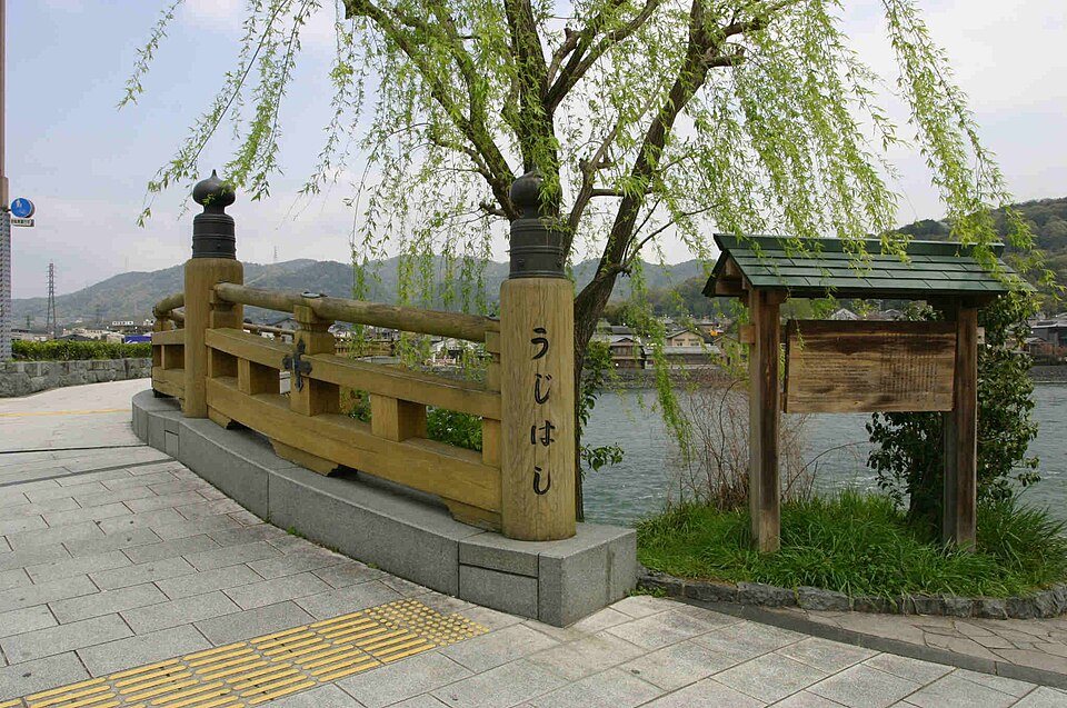
Photo: sdkfz183, 15 April 2008, via Wikimedia Commons · Public domain, released by the photographer. Resized and JPEG-compressed for this article; no cropping or retouching by LAYERS OF JAPAN.
Some stories stay with you as a tune. Others return as a view across the water.
In Sound! Euphonium, the life of a school wind band reaches beyond rehearsal. The streets, stations and riverside spaces of Uji give that story somewhere to unfold. Keihan Railway’s official collaboration guide, produced with Uji City’s cooperation, invites visitors to explore locations that appear in the anime. [1]
For a first visit, it helps to think in three scales: the bridge that brings you close to the river, the stations that connect the town to everyday journeys, and the hill that lets you see the whole landscape at once.
You can enjoy that progression without rushing between every point on a location map. Leave room for a cup of tea, a pause by the water and the walk back.
Begin where the town meets the water
Uji Bridge is one of the locations highlighted in Keihan’s official Sound! Euphonium visitor material. [1] It also makes a clear place to orient yourself before following the river.
Look upstream, then back toward the streets. A bridge lets you read a town in both directions: the banks and hills explain the landscape, while the crossing explains how people move through it. For a series with so much attention to the space around its characters, that everyday geography is part of the attraction.
Take photographs from the pedestrian space and step aside before checking a scene on your phone. A familiar railing still belongs to a working crossing, used by people with places to be.
Two Uji stations, two possible arrivals
JR Uji Station and Keihan Uji Station are different stations. JR Uji is on the Nara Line, which connects Kyoto and Nara. [2] Check the operator as well as the station name when saving a route or arranging to meet someone.
For a flexible visit, choose the arrival that suits the rest of your journey rather than insisting on one particular starting photograph. You can use Uji Bridge as a meeting point in the itinerary and then decide whether the hill, the river or a longer stop in town matters most.
Station photography works best as a short pause on the way through. Keep entrances and ticket gates clear, and avoid making passengers the subject of your pictures.
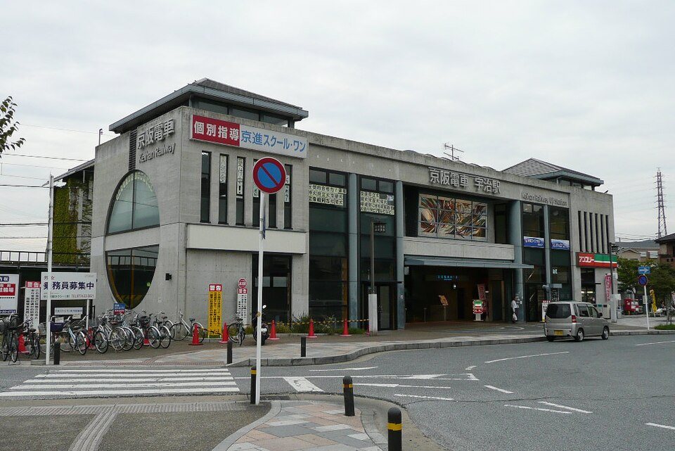
Photo: UE-PON2600, 14 October 2007, via Wikimedia Commons · CC BY-SA 3.0. Resized and JPEG-compressed for this article; no cropping or retouching by LAYERS OF JAPAN.
See the town from Daikichiyama
Daikichiyama’s observation area is another location recognised in the official visitor material. [1] Uji City describes the park as a local recreation area on the Tokai Nature Trail, with views across the city, the Uji River and Byodoin’s Phoenix Hall. [3]
The Kyoto Tourism Federation gives roughly 20 minutes from the trail entrance to the viewpoint. [4] Treat that as a guide to the ascent, not the time needed for the whole visit. Allow for finding the entrance, stopping at the top and walking down again.
For a first visit, go in daylight with comfortable shoes and water. Check local notices before starting, and turn back if conditions do not suit you. The hill is optional: a riverside walk can still be a complete and satisfying day.
From above, the pleasure changes. The streets you have just followed become part of a larger pattern of roofs, trees and water. You can trace your walk through a real town instead of trying to hold one scene still.
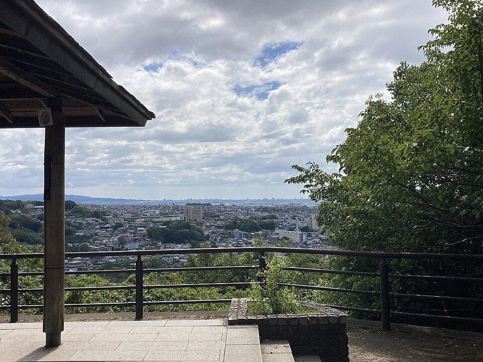
Photo: SRIA, 17 August 2024, via Wikimedia Commons · CC BY-SA 4.0. Resized and JPEG-compressed for this article; no cropping or retouching by LAYERS OF JAPAN.
Give Uji time to be Uji
The anime can bring you here, but it need not account for every stop. Uji’s historic sights, riverside park and tea shops are reasons to leave some of the day unplanned. The Kyoto Tourism Federation’s walking guide links the river islands, Asagiri Bridge and Byodoin into the wider town. [2]
Choose one addition that appeals to you. It might be time in a tea shop, a walk over a different bridge or a visit to Byodoin. Treat the latter as a separate cultural stop and check its own admission arrangements, rather than assuming it is included in an anime route.
A tea break can be the point where a location hunt becomes a holiday: put the comparison images away, sit down and decide whether you actually want another stop.
A route with space to change your mind
For a first visit, use this loose order: your chosen Uji station → Uji Bridge → a riverside walk → an optional Daikichiyama climb → tea and the return journey. Keep the hill within daylight and choose the return station that fits your onward plans.
Check Keihan’s official page for the current location map. Special trains, displays, stamp rallies and printed maps belong to particular campaigns, so do not assume an older photograph describes what will be available on your day. [1]
There is no need to add residential streets or a school entrance simply to increase the number of locations visited. A smaller route gives you more time to notice the town and makes it easier to respect the people who use it every day.
The view from the hill may be the photograph you remember first. The quieter memories—a crossing, a train arriving, the sound of water during a pause—can be just as much a part of your Uji.
About the photographs: These are real location photographs with their capture dates shown below. They illustrate the places, not an exact sequence from the anime; signs, planting and access arrangements may change. Image credits and reuse terms appear with each photograph.
Sources and useful links
- Keihan Railway: Sound! Euphonium location map and visitor information (Japanese)
- Kyoto Tourism Federation: Uji, its stations, river and historic sights
- Uji City: Daikichiyama Scenic Park (Japanese)
- Kyoto Tourism Federation: Daikichiyama trail information (Japanese)
Check current opening information, transport and local notices before travelling.








Comments